


Curry Smith Lake, Walker County, Alabama
About
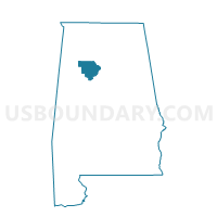
Outline

Summary
| Unique Area Identifier | 523050 |
| Name | Curry Smith Lake |
| County | Walker County |
| State | Alabama |
| Area (square miles) | 30.83 |
| Land Area (square miles) | 28.41 |
| Water Area (square miles) | 2.42 |
| % of Land Area | 92.14 |
| % of Water Area | 7.86 |
| Latitude of the Internal Point | 33.96367430 |
| Longtitude of the Internal Point | -87.17227230 |
Maps


Graphs
Select a template below for downloading or customizing gragh for Curry Smith Lake, Walker County, Alabama


Neighbors
Neighoring Voting District (by Name) Neighboring Voting District on the Map
- Abundant Life Church, Walker County, AL
- Arley Fire Department, Winston County, AL
- Black Pond Sportsman Club, Winston County, AL
- Cold Springs Fire Dept., Cullman County, AL
- Crane Hill Fire Dept., Cullman County, AL
- Old Herman Church, Walker County, AL
Top 10 Neighboring County Subdivision (by Population) Neighboring County Subdivision on the Map
- Bremen CCD, Cullman County, AL (8,283)
- Addison CCD, Winston County, AL (7,884)
- Sipsey CCD, Walker County, AL (5,613)
- Double Springs CCD, Winston County, AL (5,415)
- Manchester CCD, Walker County, AL (5,071)
- Crane Hill CCD, Cullman County, AL (2,257)
Top 10 Neighboring Unified School District (by Population) Neighboring Unified School District on the Map
- Cullman County School District, AL (65,702)
- Walker County School District, AL (52,671)
- Winston County School District, AL (16,345)
Top 10 Neighboring State Legislative District Lower Chamber (by Population) Neighboring State Legislative District Lower Chamber on the Map
- State House District 12, AL (45,798)
- State House District 14, AL (40,597)
- State House District 13, AL (39,882)
Top 10 Neighboring State Legislative District Upper Chamber (by Population) Neighboring State Legislative District Upper Chamber on the Map
Top 10 Neighboring 111th Congressional District (by Population) Neighboring 111th Congressional District on the Map
Top 10 Neighboring Census Tract (by Population) Neighboring Census Tract on the Map
- Census Tract 208, Walker County, AL (5,613)
- Census Tract 9656, Winston County, AL (5,415)
- Census Tract 209, Walker County, AL (5,071)
- Census Tract 9655.02, Winston County, AL (2,871)
- Census Tract 9657, Cullman County, AL (2,652)
- Census Tract 9655.03, Winston County, AL (2,620)
- Census Tract 9656, Cullman County, AL (2,257)